Showing posts with label map. Show all posts

Wednesday, October 21, 2015

Road Trip

My office had a lady who lived in Wisconsin. She handled about 90% of our Wisconsin business. But, she was only part time, even though there were weeks when she was working as much as the rest of us, and she wanted full-time. So, she left us September 1st for a full-time job. What that means is that the jobs she would have normally handled have to be handled by those of us in the Chicagoland office. Generally, we do more inspections in Wisconsin over a wider variety of smaller projects, than we do active on-site work. "Deb, you're the best inspector in this office." Where am I going this week?

Last week, I found myself up near Fond du Lac. I got my maps and directions and set off. I got to just south of Fond du Lac on Interstate 41 and made a right onto US Highway 151. Wait. What?
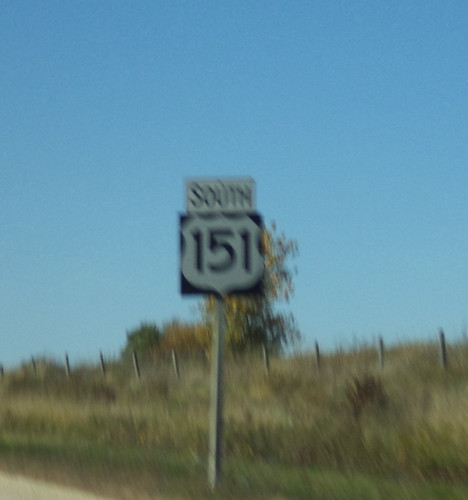

See? I was on US 151. Why should that matter? Well, when I go to Iowa, one of the routes I can use to get to mom's involves driving a chunk of 151 from Anamosa to Marion. It had never occurred to me that 151 began or ended somewhere. It doesn't have a song about it like Route 66 does. It's not considered the "arterial of the nation", as Interstate 80 is sometimes called. It's just US Highway 151. I know this number. That got me looking on Google for where this road begins and ends.

It begins in Manitowoc, Wisconsin.
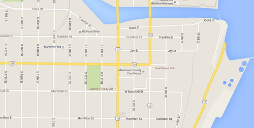

To the right is Lake Michigan. US Highway 10 is running north and south through the downtown and 151 heads west. It heads diagonally southwest through the mid-section of Wisconsin, passing Fond du Lac and Madison before exiting Wisconsin and entering Iowa at Dubuque.

Once in Iowa, it goes southwest from Dubuque past Anamosa and Marion and the Amana Colonies before ending at Interstate 80 east of Williamsburg.
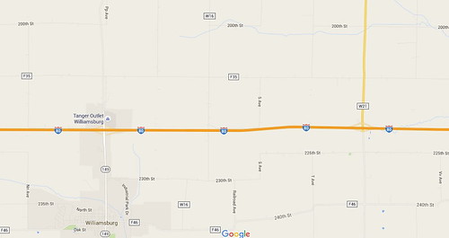

I've been on quite a bit of this road. It runs past Dickeyville, Wisconsin and I was there before my Memorial Day vacation to see Patt. I remember when we had to do on-site work when the state of Iowa widened 151 from 2 lanes to 4 and the road wound up passing close to some homes. I remember driving on sections of 151 when my parents lived in Marquette, Iowa and getting from Wheaton to Marquette was fastest taking the Interstate to Madison and then going west.

Google says the route can be driven in 6 hours. I'm tempted. I would not make it a very long day. I would drive up to Manitowoc, a place I don't think I've been, and stay overnight. In the morning, I would begin a leisurely drive southwest, stopping along the way at the historical markers and interesting places along the route. I haven't been to the grotto in Dickeyville since I was in middle school. I didn't go in May; there wasn't time. I drove by it and it didn't look all that different from what I remembered.

Dubuque is worth a couple hours. They have the National Mississippi River Museum. I watched that being built but have yet to go there. All these years of knowing the Mississippi and I've never been to the museum.

And, at the southern end are the Amana Colonies. They are worth driving there just for the history and the preservation of a way of life. It's another place I haven't been to in a very long time. For the modern world to crash down upon your senses, you drive a few miles west and go to the outlet mall. Once I get into Iowa, I have a ready made B&B a few miles north of 151, in Walker.

Oh yes, this has potential. I think about road trips I'd like to do. I would like to fill in the drive on Interstate 80 from New Jersey east to where it ends in New York City and drive west from Reno, Nevada to where it ends in San Francisco. I've driven all the rest of I-80.

I grew up along the Mississippi and am very familiar with the signs indicating a "Great River Road". I've driven all facets of that route from its beginnings at Lake Itasca in Minnesota to Keokuk, Iowa. Back in the 1970's, we took a 2-week family road trip and drove a large loop through the south, coming north from Louisiana to St. Louis before going inland and going due north to home. Some of that was on small sections of the Great River Road but we were tired at that point and Interstate was the fastest route home. A Great River Road Trip would be more than a week's worth of driving. There would be so much to see along the route and much of it is NOT interstate.

As I look ahead, briefly; gotta get through BlizzCon; to vacations in the next year, the idea of a few days spent following a road through a section of country I know reasonably well, is very appealing. I'm willing to wager you've never really looked at the numbered highways that go through your neck of the woods. Where do they begin and end? What kind of excitement would be along the way? I think I may find out.

Beverage:  Water

Deb

Sunday, June 7, 2015

The Road Less Traveled

I'm sure I've done this before in a blog post from years past. I mean, I have this poem memorized, the whole thing.

Two roads diverged in a yellow wood
And sorry I could not travel both
To be one traveler, long I stood
And looked down one as far as I could
To where it bent in the undergrowth

And took the other as just as fair
And having, perhaps, the better claim
Because it was grassy and wanted wear
Though as for that, the passing there
Had worn them nearly about the same.

And both that morning equally lay
In leaves no step had trodden black.
Oh! I kept the first for another day
But knowing how day leads on to day,
I doubted that I should ever come back.

I shall be telling this with a sigh
Somewhere ages and ages hence.
Two roads diverged in a wood, and I,
I took the one less traveled by
And that has made all the difference.

(Robert Frost)

Setting aside the metaphor for our journey through this life, I often think about this poem when I am traveling to far-flung job. I took a vacation to Minnesota over Memorial Day weekend. Tacked onto the front of the vacation was an inspection job of 5 homes near Dickeyville, Wisconsin. I know that place. I know how to get there, but I didn't know where the homes were.

Now, Dickeyville is not a huge metropolis. There is a grotto there. (I didn't stop. I should have.) Since it's off the beaten path, it's not very crowded. There are a couple of large gas stations and a couple of restaurants, but the town is not very big. I probably could have driven around and found the place where the homes were. But, because I was on the clock and I wanted to be efficient with my time, I looked up the addresses in Google maps.

MapQuest, Bing Maps, Google Maps; all web sites where you can get driving directions from point A to point B. Plug directions into your smart phone and a somewhat comforting female voice will say, "Turn left at the next intersection, in 500 feet." You get where you're going, usually. Sometimes relying on that comforting female voice instead of map reading skills will get you in trouble.

I don't care for verbal directions unless they come from someone sitting next to me, reading where I have to go. I'm very much old school in that I want my directions printed out. I can read a map. I know how to use that information. Map reading was taught in school. It was deemed a necessary skill to have. If our entire GPS network were to crash, I could still find my way to a new location because I know how to read a map and follow directions.

We do complain about the directions given out by online map services. "I think I can get out of my neighborhood," we say when the directions tell you to "go south and then turn right onto Liberty. Go two blocks and turn left onto Blanchard. At the 'y' intersection, stay to the right and go onto Willow. At the next stop sign, turn left onto President." Yes, thanks. I know that. I go that route to the Dunkin' Donuts. Companies have amended their directions so you don't have to print what you don't need. Sometimes, you have an option for a scenic, as opposed to direct route. Still, the directions can be head-scratchingly strange.

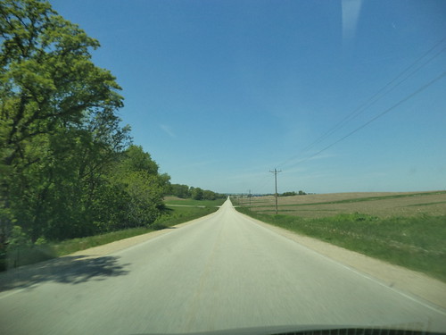
Thanks to Google Map's directions, I found myself on this road while heading from my home to Dickeyville.


This is Wisconsin Highway W near Shullsburg. The most direct route took me down 2 lane highways in south and southwest Wisconsin, very nearly deserted of vehicles.

The same was true of driving home from Minnesota. Although the directions seemed clear and the roads recommended were among the more well-traveled, sometimes, the signage can leave a little to be desired. I missed a turn and found myself heading east on nearly deserted roads.


Unlike the trip to Dickeyville, where I was on a clock, coming home, I had time to wander. I did think about turning on my phone's GPS to figure out where I was but I knew the interstate was south of me. So if I headed south, eventually, I'd find it and I could continue east and home.

Still, I took the one less traveled by. Did it make any difference? Probably not, but I got to see sections of the country I wouldn't see if I hadn't relied on "the most direct" and then missed a sign. I think we can close ourselves off from the joy that comes in the road less traveled. If you have the time to wander, I think it revitalizes the soul.

Beverage:  Irish Breakfast Tea

Deb

Thursday, October 24, 2013

Richmond

Richmond, Virginia is an old city. Living in the Midwest, we can often overlook the fact that when we consider "old", say early 19th century, the east coast has places 200 years older than that. The locality we know as Richmond is a case in point. There was a settlement in the vicinity in 1609. The present city was founded in 1737.The James River runs just south of the downtown. Carole lives in a suburb and commutes about 15 minutes into downtown Richmond.

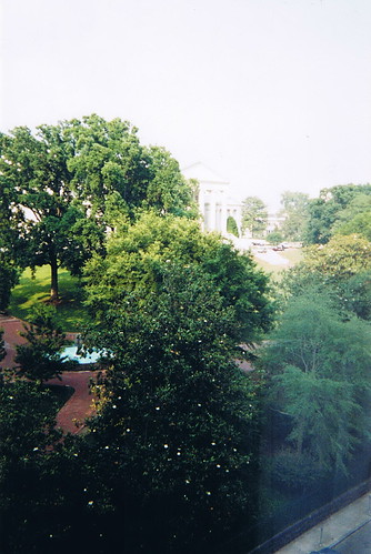
It's rather ironic that, in 2001, we visited Richmond for her post-high school graduation Civil War battlefields vacation. We stayed at a luxury hotel right off capitol square in downtown. (The hotel is still there. I forgot to photograph it when I was there.) This was the view from our hotel window in the morning.


The white speckles on the tree in the foreground are magnolia blossoms. The actual capitol building is in the upper center.

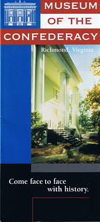
We were in Richmond to visit the Museum of the Confederacy. At the time, they were mounting the biggest exhibit assembled to date, of Robert E. Lee memorabilia. We knew nothing of this museum, in fact, the article where we noticed the exhibit called it an "unknown gem". Given the feelings provoked by the Civil War, a museum dedicated to the Confederacy could be a lightning rod for all sorts of ideas. As 'Northerners', we have our own feelings about this time in US history. Carole had done some research on the war and felt that Robert E. Lee's personal conflict was not as examined as it should be. She really wanted to see this exhibit, so we amended our travel route and added Richmond to the itinerary.

The exhibit was incredible. Lee was a much decorated and respected general when the war broke out. It's well-known that he chose to go with the Confederacy because Virginia, his home state, seceded from the union. It did not make him happy. He fought against people he considered friends. I remember seeing letters from Lee to friends where he talked about his anguish. I believe there were uniforms, weapons, paintings and Lee's death mask. We came away from the exhibit with a new-found appreciation of just how much the war took a toll on Lee personally. And we found the museum to be simply a repository for items from that conflict. They don't really get into the whys or the ramifications of the war. They present what they have as 'this is what this is'. It really is a gem of a museum and I would urge you to go visit if you're close by.

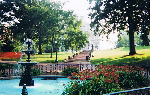
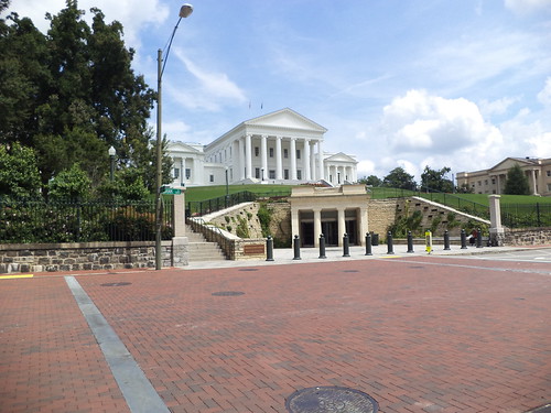
It's a three block walk from the Virginia capitol building. The park surrounding the capitol is very nice. In 2001, I took this photo as we walked from our hotel to the museum.


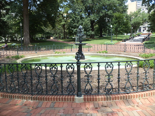
The steps lead to a statue of George Washington. In 2013, the fountain is still there.


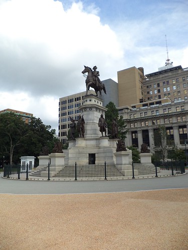
The steps still lead to a statue of George Washington.


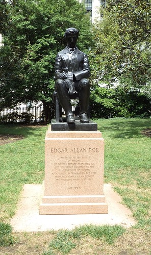
There's a small statue of Poe sitting off to the side. I don't remember seeing this before.


We did not take the capitol tour in 2001 as we were there for one specific reason. There is a new entry to the capitol building and it advertised tours. I didn't take the tour either as I was in downtown for two specific reasons; to see where Carole works and to visit the museum again.


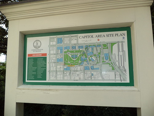
I'm a big one on maps and certainly appreciate when an area is presented visually.


I entered the area of the capitol from the upper right of the map and walked to the lower left. Carole can see the building from her office area.

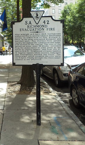
There is so much history here. I encountered this memorial plaque as I was walking to Carole's office.


This talks about the fires set by Confederate soldiers in April of 1865 as the Union army closed in on the city. Carole mentioned that several of the signers of the Declaration of Independence, including George Washington and Thomas Jefferson, were meeting in Richmond at a time when the British army was approaching the city. Thanks to some fast thinking, the army was delayed just enough to get those men out of Richmond and to Charlottesville, 70 miles west of Richmond. Had they not been warned to leave, the Revolutionary War might have been a mere skirmish. It's easy to forget that part of Richmond's history as so much was tied up in the Civil War. To rectify that, Richmond developed the Richmond Liberty Trail.


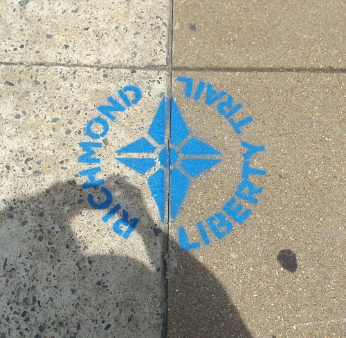
This is painted on the sidewalk. This is self-guided and goes all over downtown Richmond. There is no real beginning to the trail. I must have seen a half-dozen of these on the sidewalk in my walk. Further research indicates this trail overlaps with two other walking trails, both self-guided. It's so easy to forget that the US history here predates items with which I'm familiar.

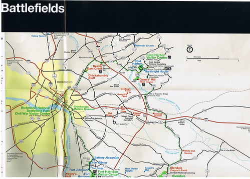
I wanted to visit Cold Harbor Battlefield while I was there. In 2001, we visited Tredegar Iron Works, which is the 'official' starting location for Civil War tours in Richmond.


But, on Wednesday, when I set out, I copied one direction wrong and ended up in an area that didn't seem right. After driving around for an hour, I never did find the battlefield and felt that I could get myself horribly lost so, when I found I-95, I headed back to Carole's. It was only when I was looking through our 2001 trip that I found the battlefield map we'd picked up. I should have brought it along.


When you combine the history from Revolutionary War days with Civil War days, there is a lot to see. It appears Carole is going to be settled in this area for the foreseeable future, perhaps this is now her home. With enough visits, I can maybe get around to all these places. And the walking is good for me.

Beverage:  English Breakfast tea

Deb

Wednesday, October 16, 2013

The Nation's Yard

Because of the unpleasantness of a government shut-down, there has been a minor discussion about The National Mall. The Merriam-Webster dictionary defines "mall" thusly:

[The Mall, promenade in London, originally a pall-mall alley]
a :  a usually public area often set with shade trees and designed as a promenade or as a pedestrian walk
b :  a usually paved or grassy strip between two roadways 
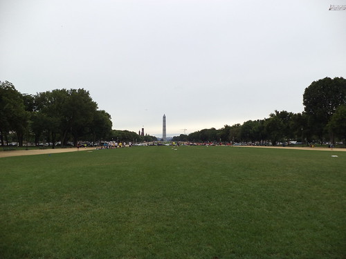
If you do a Google maps search for Washington DC, it's extremely easy to find the Capitol, the Washington Monument, The White House and the Lincoln Memorial. Just zoom in until you see a large expanse of green. Those places delineate The National Mall.

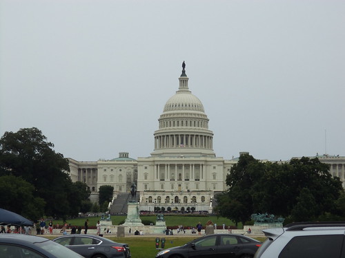
With the shut down, NPR did a brief discussion of just what this public space is and what does it mean for us. When you think of the protests, gatherings and events in Washington DC, this is the place to go. From the Captiol building on the east ...


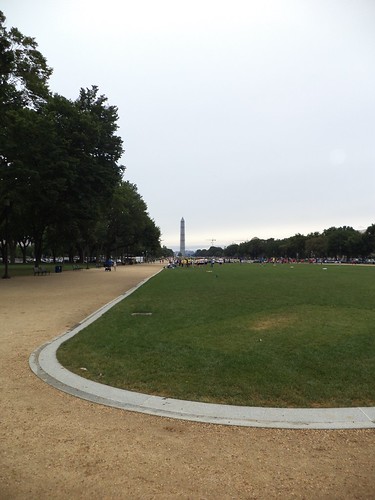
... to the Washington Monument, ...


it is a walk of 1.2 miles. Along the way, the nation's heritage is available for all to see and visit. All these buildings were closed during the shut down. As the mall gets upwards of 24 million visitors a day, that's a lot of people unable to see and experience who we are. 

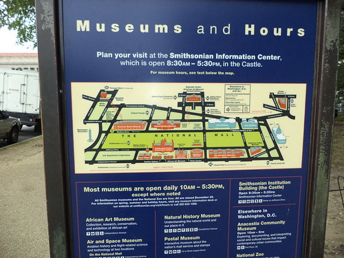
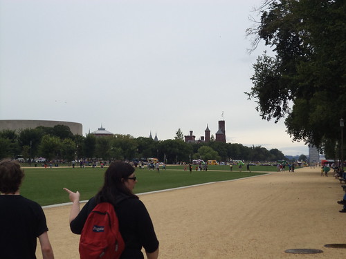
As we walked west, I took photos of some of the buildings along the way. Having Phil with us was a great help. "What's that building?" I'd ask. "That's um...the National Portrait Gallery, I'm pretty sure," he'd respond. It wasn't until we got to the Washington Monument that there was an actual map of what museums lined the Mall. 


This is the Smithsonian Air and Space Museum. 


This is the iconic Smithsonian Castle. It was the original museum but now is administration. 


Air and Space is toward the middle of this section of the Mall. The "castle" is near the Washington Monument.


This is the National Museum of American History. This building is huge. It's also located near the Washington Monument, across the Mall from the Smithsonian castle.


This is the National Gallery of Art-West Building. I could see spending a whole day just in the west and east buildings.


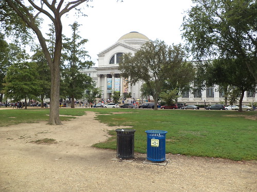
This is the National Museum for Natural History. This is another place I could spend an entire day. I know me.


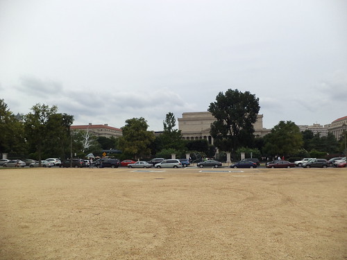
There are other buildings that I didn't think to write down their names. Phil thought this was the National Archives. I drool at the thought of being surrounded by the nation's important documents.


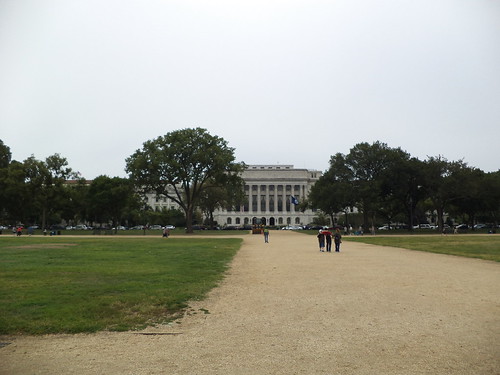
And there's this building which is, Phil thought, a part of the administration of the Smithsonian's various museums.


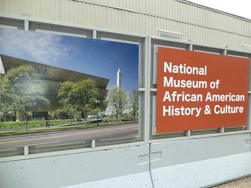
Joining this august array will, in June of 2014, be the National Museum of African-American History and Culture. It will be located just a block north of the Washington Monument.


So many places to go and see. Spending a day in each one is not a far-fetched idea. All of these museums are free. They exist via our tax dollars and via membership. You may come and go as you like, picking and choosing which parts you will see on which day. 

It seems, to me, to be right that the repositories of our heritage should be located along what could be termed our front lawn. When we were there, frisbee football events were taking place on sections of the mall. I look at photos from other large events and I think, "I know where that was. I was there." 

I think one of the best examples of how much this is our park was seeing the lines of food trucks set up about half-way down the Mall. 


Yes, the garbage cans in this area were overflowing, but you could get anything you desired to eat, anything. If you wanted it and it wasn't on a food truck, you didn't want it. We had eaten before walking so I didn't check out the prices for viands. It was amazing, however, to see so many food options in two blocks.

The National Park Service is tasked with keeping the space of green useable for all of us. 


Having walked the nearly 2 miles from end to end, I can say they do a fantastic job. The Nation's Front Yard. Yes, that's an apt description.

Beverage:  Dr Pepper

Deb

Transport Me

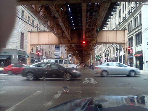
The thing about living in Chicagoland is that you quickly learn how to use mass transit. It's a ubiquitous part of life in this metropolitan area. If you live in "the city", as Chicago is known, the elevated, or "the el", as it's known, is, for the most part, within walking distance of your house.


It goes to both airports and makes a loop around the downtown. It's that circle of the el, part of which is shown above, that gives the downtown of Chicago the moniker, "The Loop".

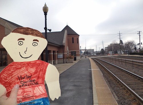
Transportation into the city is via a number of spokes, one of which, the western line of Metra (Metropolitan Rail Transit Authority), goes through Wheaton where I live. When Flat Stanley came to visit, back in March, we went to the Metra station.


So, when Carole said we were taking the train into DC, I was excited. I like public transportation. I think there should be more of it; more busses and trains to get us around the urban and suburban areas where we live. Perhaps you'd have to wait 10 minutes for the next bus or train, but being able to get where you want to go without adding your car to traffic should be an option.

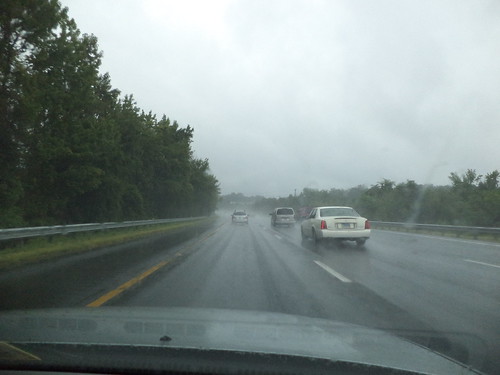
Unfortunately, unless you make reservations on Amtrak, a trip into DC from Richmond involves a drive north on heavily congested Interstate 95 to the end of the blue and yellow lines at Franconia/Springfield. It was a rainy day to start.


I'm pretty inured to traffic but here it is, Sunday morning and it just wasn't moving in spots.

The station at Franconia/Springfield is multi-purpose in that it serves not only the metro but also busses.


It's very modern, sleek and clean. Coming from a city where the el stations can be upwards of 80 years old, this was quite the difference.

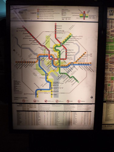
There are clear, easy to read, maps everywhere.


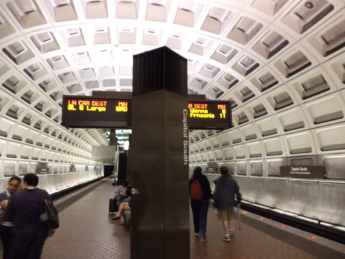
There was a brief discussion on where would be the best stop to disembark. We decided the Capitol South station was the best place to get off. Ticket kiosks could be a bit better designed. Carole had to help me buy my ticket because I was confused. This could be because I'm quite used to buying tickets for the el and I have to remember, different city, different kiosk. Once the ticket was in hand, we descended into the bowels of the station.

I never did figure this out.


This sign tells you which train is coming and how soon it will arrive. We're at the Capitol South stop and heading out of the station. There are incoming trains to this station. I guess you learn when you have to or choose to ride this every day, but I never did figure out which train was coming. In Chicago, train cars have colored placards on the side of them. When a car is hooked to a train, and there are more at rush hour, naturally, than off-peak hours, the placard is changed to the color of the train on which the car will be used. When the train pulls up to a station, you can instantly tell if this is your train. I didn't see this system at all in the DC metro. Heading back, after walking the Mall, I had to rely on Carole's reassurances that our train was coming and not to get on the one that pulled up.

This blue/yellow line took us past Regan Airport. There were a lot of people with luggage getting on and off at this spot.


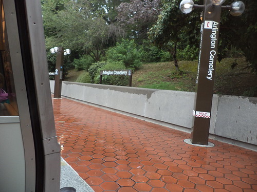
We also stopped at Arlington Cemetery.


You can't see anything from the metro, but it's nice to know that some day, when I come to visit, this could be a stop on a day's adventure. It's one of the places I've always wanted to visit.

The Capitol South stop put us one large block south of the Capitol building.


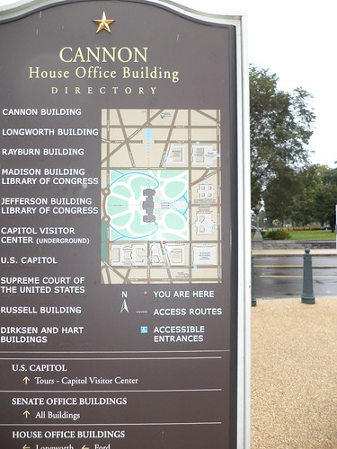
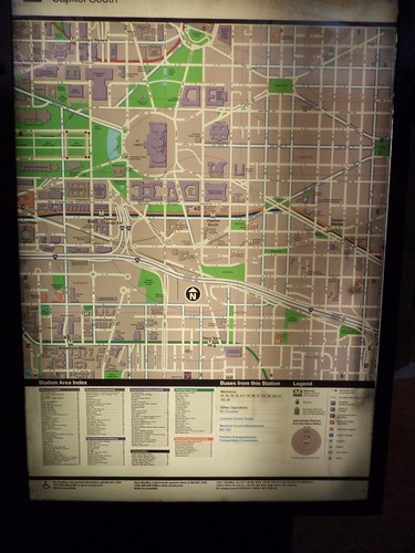
Maps are everywhere; in the metro both before and after you get a ticket, and on signs all around the area. This one was by the Canon Building.


Don't see what you're looking for? Walk to one of the other places located on the map and there will be another sign pointing you in, probably, the correct direction.

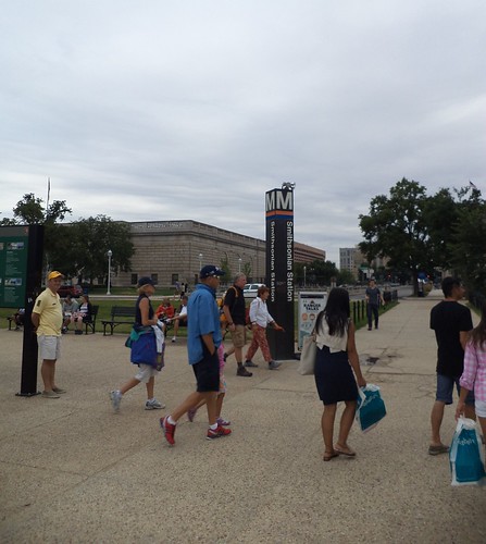
Coming back, after walking all over and deciding it was time to head home, we went to the metro stop outside the Smithsonian building.


Metro entrances are clearly marked and have maps showing you where you can go from this station. If you need to transfer to a different line, they show you that too.

I enjoyed riding the metro even if I was a bit concerned at the Smithsonian Station about being able to sit down on any train we'd get on. There were a lot of people and, by the time we got to the station, my legs, feet and hips hurt. As it happened, most people got on an orange line train so there were very few people on a blue line train. Could have fooled me how they knew.

When I go back to visit Carole again, assuming we have the time, there are an abundance of places to visit. I only got a very miniscule taste of what is offered in the nation's capital. Taking the metro and walking, while a test of my endurance, is the best way to see things. I know, from listening to friends talk who live in the area, the metro is being expanded to other suburbs in an effort to alleviate DC's traffic congestion. I'd entertain the idea of riding the metro end to end, just to say I'd done it. Besides, the station architecture isn't unpleasant.


Beverage:  Dr Pepper

Deb
Sunday, August 9, 2009

AWK! Blog post! Blog post!

On Friday, August 7th, I had to go back to Fort Madison to service one of the machines on this highway job. It quit calling out remotely on the 26th. We were having such problems with the communications on all our remote units that we weren't sure if this was a communication problem or if the machine had a problem. It seems the battery on the machine had been drained. That'll do it. Low battery means it won't call out, no matter how hard it tries. It also means a 5 hour one-way trip to fix this. And with the communication problem, we aren't exactly sure that replacing the battery will make the machine call in.

Oh well. It gives me something to do.

I head west. It's a heavily overcast day with the threat of rain. I drive through some spitting showers, nothing major until I get to 40 minutes from Iowa on I-80.

You know these kinds of rains. God unzips the rain clouds and has his angels overturn buckets of wash water. You can't see. Sky, horizon and ground meld into a gray gauze. Instinctively, you take your foot off the accelerator because if anything happens in front of you, you want to be able to stop. Westbound traffic is relatively light so I peer into the immediate distance trying to get some idea of where I am. I have to get off I-80 and head south to Galesburg, but I can't see road signs for where I am.

Too late, the exit for I-74 to Peoria wanders by and I realize I have missed my turn. I push onward hoping there will be some identifying marker that tells me I can get off and turn around, but there isn't one. 10 minutes more and the rain ends, leaving the pavement covered in water. The Mississippi River bridge looms ahead and I am in Iowa.

I take a quick glance at the map and exit at Route 67 south. I have to go south to Fort Madison. The sky ahead is that deep blackish blue of an impending storm. As I am driving south through Davenport, the sky opens again. I unzip part of the window and smell the familiar odor of a Midwest summer thunderstorm.

It's hard to describe it, particularly along the river. There is the smell of the earth, the smell of mud, the smell of water and the smell of humanity. A series of hard storm like this washes away the urban smell and replaces it with a fresh smell. I love to walk in the rain and smell the earth and the water. Even a driving rainstorm, as long as there is no lightning, is a wonderful feeling. Rain water is good for your hair and skin and sitting on the deck at night with a cup of tea getting drenched in the summer is heaven.

I continued south. By the time I got to Fort Madison, the sun had come out on a few occasions and steam was rising from the small woods or hollows visible from the road. I got some lunch and headed to the non-working instrument. One battery change, a 15 minute job, and the machine called out on its own. A crack gauge I had installed on the south side of the house fell off so I had to install another one. We use hot glue to affix it to the brick. A liberal application of rubbing alcohol will dissolve the glue and pop off the gauge.

It took a few minutes because the gauge wouldn't stick at first. Then I didn't have enough glue and it had started to rain lightly again and I was getting soaked. When the gauge finally stuck, I stood up and bent over to pick up my bag. Attached to my jeans was the largest bug I had ever seen. It looked like a june bug on Miracle Gro AND steroids. It was light green with red tinges. I have no idea what it was, but I brushed it off quickly, grabbed my bag and walked smartly to the Jeep, whose passenger door was standing open in an ever increasing shower. The communications center in Atlanta, Georgia called to tell me my machine had called in and done a full download. I hopped into the Jeep and thought, "Dang! That would have been an incredible blog post!"

So, I got out of the Jeep and went to find the bug, but it was gone. I got back into the Jeep and headed home, stopping in Fort Madison for $2.45 per gallon mid-grade blend gas.

That, dear reader, is a synopsis of what I do. The money I'll get for expenses based on mileage will cover the rest of this month's bills AND pay for more blood tests for Betsy to see how much fluids she should get. I used to put 300 miles on a week but I run the office more these days. Part of me misses the time spent in the car on job sites, but most of me is grateful for not climbing in and out of cars and quarries and construction sites. Life is a series of trade-offs. I enjoyed classical music on my CD player while driving through rain storms. It was okay.
Beverage: Strawberry Crush

Deb