Showing posts with label park. Show all posts

Thursday, February 9, 2017

The Things I See - Public Space - Part 4

One final note on Old St. Patrick's Church. One weekend every summer, the intersection of Adams and Halsted is closed for "The World's Largest Block Party". I remember when they held their first one. It was to raise money to fix something in the church. Membership had declined and the Archdiocese of Chicago was considering closing the church. The block party was touted as a way for the city to recognize the historic significance of the church and to support keeping it alive. I think the party stretched over a weekend. Now, it's just one full day, but proceeds still benefit the church and its attached school.

At the time of the first block party, the neighborhood was crumbling. I'm thinking it was early 1980's when they did the first one. In my 17 years with Vibra-Tech, I've seen huge redevelopment of the area around the church. There are groceries and restaurants and condos. Channel 26, WCIU, is here. Oprah's old studio is a half-mile away. That site is currently being redeveloped. A lot of the seedy bars have been removed. A hotel is going in up the street. Greektown starts immediately south of the church and there are many restaurants which have come into that area.

Across the street is a park. The park contains a statue.


On this day, the benches in the park were full of people eating lunch, reading, listening to music, looking at their phones, etc.


The statue, a gift from Chicago's sister city, Galway, Ireland, is meant to represent the Irish immigrants who left their homeland and came, specifically, to Chicago. These immigrants built and maintained this church.

The green space to the north and east of this statue had children playing. Every city needs these kinds of spaces. There is a parking lot to the north which I can see becoming redevelopment material at some point, given all the construction in the area. But this space won't be developed. That's good.

Beverage:  Assam Tea

Deb

Saturday, October 26, 2013

A Golden Lady

Many years ago, at the Printer's Row Book Fair, I stumbled upon this reproduction print.


The scan doesn't cover the sides completely but you see most of this. This print is of a photo of the Statue of the Republic and Peristyle which was in the Court of Honor at the World's Columbian Exposition held in Chicago beginning in May 1893, and running to October 1893. The fair was designed to honor Christopher Columbus' discovery of the Americas in 1492. Although the area where the fair was located was dedicated in 1892, due to construction and other issues, it wasn't opened until 1893.

The fair is known for things like the forerunner to the zipper closure, Juicy Fruit Gum, Pabst Blue Ribbon Beer and spray painting. Frederick Law Olmstead, America's premier landscape architect at the time, designed the 650 acres which encompassed the park. Over 700,000 people attended the fair and marveled at things like the fully electric kitchen and the world's first Ferris Wheel. That particular ride was moved north to Lincoln Park and then to the St. Louis World's Fair. After that fair, it was destroyed.

Chicago received benefits such as the land where the fair was becoming Jackson Park. The Museum of Science and Industry, one of the crown jewels of Chicago museums was, originally, The Palace of Fine Arts. The Museum gives guided tours of its building detailing its original role in the fair and the innovations which came from this event.

One of the most visible remnants of the fair can be found at Hayes Drive. I have long admired this statue.


If you notice, it bears a startling similarity to the statue at the exposition. It's supposed to. Daniel Chester French, an extremely prolific American sculptor, designed and built the original statue. The original statue at the exposition was 65 feet tall and was at the eastern edge of the fair, facing west. The current statue faces east. A pier, located behind the original, was a point of entry for many visitors. They "rode" to the fair entry, located under the arch in the top photo, on a moving sidewalk, the first of its kind. Most of the buildings at the fair were constructed with plywood and a building material called "staff", made of plaster of paris and hemp, insulated with straw. The walls were then whitewashed which gave the exposition the nickname "The White City". When the exposition was over, the buildings were torched. It was a great event in Chicago and people came from all over to watch the city within a city burn to the ground. The statue was dismantled.

The statue was supposed to represent the resilience and strength of a country that had come through a Civil War. Plus, immigrants from all over the world, were flocking to the open arms of the US. Six years previous to the fair, the Statue of Liberty had been dedicated in New York. You can see the influence of that statue in French's design.

In May of 1918, on the 40th anniversary of the fair and the 100th anniversary of Illinois becoming a state, this statue was unveiled. It's 24 feet high, of gilded bronze, and stands on a specially built pedestal. French assisted Henry Bacon in reproducing his original design. French and Bacon went on to design the Lincoln Memorial.

When I have to come to the south side of Chicago on business, I make sure my drive takes me by this statue. Chicago has a huge number of public statuary but this is my favorite. Even on overcast days, she gleams. I'm not sure what they do to keep her gilded but, whatever it is, it's a wonderful job. If you'd like to read more about this statue, go to this link. Another extremely good source of information about the exposition is Erik Larson's book, Devil in the White City. It's an extremely well-written and deeply researched story built around the fair.

Some day, I hope to redo the room where the litter boxes are and this is one of the pieces I want to frame and put on the wall. Some day.

Beverage:  Lady Gray tea

Deb

Thursday, October 24, 2013

Richmond

Richmond, Virginia is an old city. Living in the Midwest, we can often overlook the fact that when we consider "old", say early 19th century, the east coast has places 200 years older than that. The locality we know as Richmond is a case in point. There was a settlement in the vicinity in 1609. The present city was founded in 1737.The James River runs just south of the downtown. Carole lives in a suburb and commutes about 15 minutes into downtown Richmond.

It's rather ironic that, in 2001, we visited Richmond for her post-high school graduation Civil War battlefields vacation. We stayed at a luxury hotel right off capitol square in downtown. (The hotel is still there. I forgot to photograph it when I was there.) This was the view from our hotel window in the morning.


The white speckles on the tree in the foreground are magnolia blossoms. The actual capitol building is in the upper center.

We were in Richmond to visit the Museum of the Confederacy. At the time, they were mounting the biggest exhibit assembled to date, of Robert E. Lee memorabilia. We knew nothing of this museum, in fact, the article where we noticed the exhibit called it an "unknown gem". Given the feelings provoked by the Civil War, a museum dedicated to the Confederacy could be a lightning rod for all sorts of ideas. As 'Northerners', we have our own feelings about this time in US history. Carole had done some research on the war and felt that Robert E. Lee's personal conflict was not as examined as it should be. She really wanted to see this exhibit, so we amended our travel route and added Richmond to the itinerary.

The exhibit was incredible. Lee was a much decorated and respected general when the war broke out. It's well-known that he chose to go with the Confederacy because Virginia, his home state, seceded from the union. It did not make him happy. He fought against people he considered friends. I remember seeing letters from Lee to friends where he talked about his anguish. I believe there were uniforms, weapons, paintings and Lee's death mask. We came away from the exhibit with a new-found appreciation of just how much the war took a toll on Lee personally. And we found the museum to be simply a repository for items from that conflict. They don't really get into the whys or the ramifications of the war. They present what they have as 'this is what this is'. It really is a gem of a museum and I would urge you to go visit if you're close by.

It's a three block walk from the Virginia capitol building. The park surrounding the capitol is very nice. In 2001, I took this photo as we walked from our hotel to the museum.


The steps lead to a statue of George Washington. In 2013, the fountain is still there.


The steps still lead to a statue of George Washington.


There's a small statue of Poe sitting off to the side. I don't remember seeing this before.


We did not take the capitol tour in 2001 as we were there for one specific reason. There is a new entry to the capitol building and it advertised tours. I didn't take the tour either as I was in downtown for two specific reasons; to see where Carole works and to visit the museum again.


I'm a big one on maps and certainly appreciate when an area is presented visually.


I entered the area of the capitol from the upper right of the map and walked to the lower left. Carole can see the building from her office area.

There is so much history here. I encountered this memorial plaque as I was walking to Carole's office.


This talks about the fires set by Confederate soldiers in April of 1865 as the Union army closed in on the city. Carole mentioned that several of the signers of the Declaration of Independence, including George Washington and Thomas Jefferson, were meeting in Richmond at a time when the British army was approaching the city. Thanks to some fast thinking, the army was delayed just enough to get those men out of Richmond and to Charlottesville, 70 miles west of Richmond. Had they not been warned to leave, the Revolutionary War might have been a mere skirmish. It's easy to forget that part of Richmond's history as so much was tied up in the Civil War. To rectify that, Richmond developed the Richmond Liberty Trail.


This is painted on the sidewalk. This is self-guided and goes all over downtown Richmond. There is no real beginning to the trail. I must have seen a half-dozen of these on the sidewalk in my walk. Further research indicates this trail overlaps with two other walking trails, both self-guided. It's so easy to forget that the US history here predates items with which I'm familiar.

I wanted to visit Cold Harbor Battlefield while I was there. In 2001, we visited Tredegar Iron Works, which is the 'official' starting location for Civil War tours in Richmond.


But, on Wednesday, when I set out, I copied one direction wrong and ended up in an area that didn't seem right. After driving around for an hour, I never did find the battlefield and felt that I could get myself horribly lost so, when I found I-95, I headed back to Carole's. It was only when I was looking through our 2001 trip that I found the battlefield map we'd picked up. I should have brought it along.


When you combine the history from Revolutionary War days with Civil War days, there is a lot to see. It appears Carole is going to be settled in this area for the foreseeable future, perhaps this is now her home. With enough visits, I can maybe get around to all these places. And the walking is good for me.

Beverage:  English Breakfast tea

Deb

Thursday, October 17, 2013

America's Garden

It's Carole's favorite place to visit in Washington DC.


This is the view of the United States Botanic Garden from Bartholdi Square across the street to the south. Normally, the square is a meeting place with food vendors but on the day we visited DC, the warm summer rain had prohibited the vendors from showing up.

The garden consists of two parts, an interior and and exterior area. Within these areas are different sections which show off the varied climate of the United States.

Sculpture abounds around the outside. We were greeted by a giant earwig.


While I understand the earwig's part in maintaining a good garden habitat, I squish them every chance I get. Sorry Mother Nature. There are just some insects; June Bugs, Mayflies, mosquitoes and earwigs come to mind; that I really wonder why we can't just exterminate them all as they don't seem to serve a useful purpose.

The garden outside has a rose garden and it's the first place you encounter if you enter via Independence Avenue. There are more than just roses in this garden.


I don't remember the name of this striking Asiatic lily.

There is a regional garden which was marked by an explanation of bees.


The plaque at the lower right in the photo, didn't explain, as well as it could have, the hugely important role of bees in pollinating the nation's food supply. Colony collapse disorder is a major problem, leading to a lack of bees. Butterflies, moths and bats simply can't step up and fill in. It's probably not the place of the national garden to point out how habitat destruction and the use of pesticides could make it exceedingly difficult, in years ahead, to supply food without pollinators.

There is a stream that runs through this outdoor garden.


The murmur of the water made this an exceptionally peaceful place. As the garden is free admission, if I worked in the hecticness of nearby office buildings, I could see this as being a place of refuge from that breakneck pace.

There is also a small pond.


Benches are strategically placed to allow one to better enjoy what is crafted here within walking distance of Congress. In the background is a small amphitheater where presentations about gardens are given.

From here, we walked to the main building past this interesting fountain.


You go up the steps and to the left, walking under an arbor. In this area, we found a butterfly.


This area has been developed as a butterfly garden. Due to the rain, there were no butterflies around. There was a very ornate sundial. I really like the addition of the hours in Roman numerals. I wonder if someone adjusts the dial for daylight savings time or if they just leave it.


Scattered about this section were these benches. I would love to have one on my deck.


What do you think? $200 for this?

We went inside the building. It contains two courtyards and 10 separate rooms under glass. When you walk into the front area, you see this intricate compass on the floor.


You are surrounded by trees, two stories tall.


You can go right, left or straight and be assured of seeing everything within 45 minutes.

There's a room for orchids and medicinal plants. There's a room illustrating desert ecology.


The children's garden, one of the two courtyard areas, contained a lovely hummingbird sculpture.


This is where the "typical" garden plants were found.

In the room showing off Hawaii's unique ecology, misters were everywhere.


It was a humid day in DC to begin with but it's not enough to help these plants thrive.

The main building, the large structure seen in the very first photo, is the jungle room.


There were palms and all sorts of flowering plants native to a jungle environment. There is a second floor walkway. We didn't go up there as it seemed to be where most people were going and was quite crowded.

This is a lovely place, not too big and not too small. A great deal of care has been given to creating gardens exemplifying unique climates. This is a place where spending a day with a camera is not out of the question. I'll bet it's incredibly beautiful at Christmas.

Beverage:  Lady Grey Tea

Deb

Wednesday, October 16, 2013

The Nation's Yard

Because of the unpleasantness of a government shut-down, there has been a minor discussion about The National Mall. The Merriam-Webster dictionary defines "mall" thusly:

[The Mall, promenade in London, originally a pall-mall alley]
a :  a usually public area often set with shade trees and designed as a promenade or as a pedestrian walk
b :  a usually paved or grassy strip between two roadways 
If you do a Google maps search for Washington DC, it's extremely easy to find the Capitol, the Washington Monument, The White House and the Lincoln Memorial. Just zoom in until you see a large expanse of green. Those places delineate The National Mall.

With the shut down, NPR did a brief discussion of just what this public space is and what does it mean for us. When you think of the protests, gatherings and events in Washington DC, this is the place to go. From the Captiol building on the east ...


... to the Washington Monument, ...


it is a walk of 1.2 miles. Along the way, the nation's heritage is available for all to see and visit. All these buildings were closed during the shut down. As the mall gets upwards of 24 million visitors a day, that's a lot of people unable to see and experience who we are. 

As we walked west, I took photos of some of the buildings along the way. Having Phil with us was a great help. "What's that building?" I'd ask. "That's um...the National Portrait Gallery, I'm pretty sure," he'd respond. It wasn't until we got to the Washington Monument that there was an actual map of what museums lined the Mall. 


This is the Smithsonian Air and Space Museum. 


This is the iconic Smithsonian Castle. It was the original museum but now is administration. 


Air and Space is toward the middle of this section of the Mall. The "castle" is near the Washington Monument.


This is the National Museum of American History. This building is huge. It's also located near the Washington Monument, across the Mall from the Smithsonian castle.


This is the National Gallery of Art-West Building. I could see spending a whole day just in the west and east buildings.


This is the National Museum for Natural History. This is another place I could spend an entire day. I know me.


There are other buildings that I didn't think to write down their names. Phil thought this was the National Archives. I drool at the thought of being surrounded by the nation's important documents.


And there's this building which is, Phil thought, a part of the administration of the Smithsonian's various museums.


Joining this august array will, in June of 2014, be the National Museum of African-American History and Culture. It will be located just a block north of the Washington Monument.


So many places to go and see. Spending a day in each one is not a far-fetched idea. All of these museums are free. They exist via our tax dollars and via membership. You may come and go as you like, picking and choosing which parts you will see on which day. 

It seems, to me, to be right that the repositories of our heritage should be located along what could be termed our front lawn. When we were there, frisbee football events were taking place on sections of the mall. I look at photos from other large events and I think, "I know where that was. I was there." 

I think one of the best examples of how much this is our park was seeing the lines of food trucks set up about half-way down the Mall. 


Yes, the garbage cans in this area were overflowing, but you could get anything you desired to eat, anything. If you wanted it and it wasn't on a food truck, you didn't want it. We had eaten before walking so I didn't check out the prices for viands. It was amazing, however, to see so many food options in two blocks.

The National Park Service is tasked with keeping the space of green useable for all of us. 


Having walked the nearly 2 miles from end to end, I can say they do a fantastic job. The Nation's Front Yard. Yes, that's an apt description.

Beverage:  Dr Pepper

Deb

Sunday, April 21, 2013

A Trip Around Wheaton

One of the last things I did with Flat Stanley was take him around Wheaton, where I've lived for over 30 years.

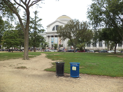
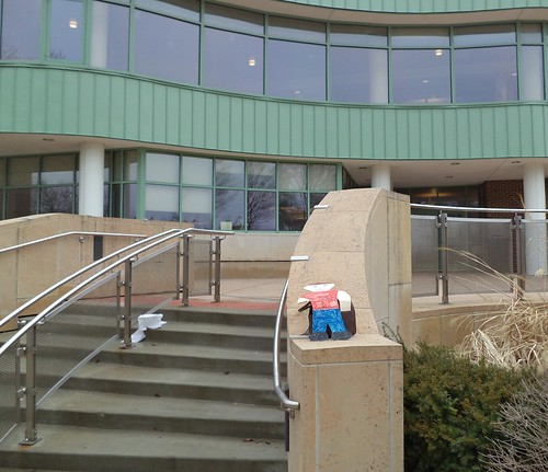
We started at Adams Park. It's a large park just to the north of downtown. It used to be framed by streets but several years ago, the library got the eastern street vacated and they expanded, building an entrance accessible from the park.


I haven't been in the new addition since it opened. I used to use the library all the time. I knew several of the librarians, but I've found that my need for what they offer is, currently, non existant. That might be a reflection on society in general as people can find things they used to go to the library for, online. Libraries should never go away and I'll generally always vote for a library referendum, unlike some other tax increases. If you're interested, go here and watch the video about the Troy, Michigan library's funding campaign. Inspired.

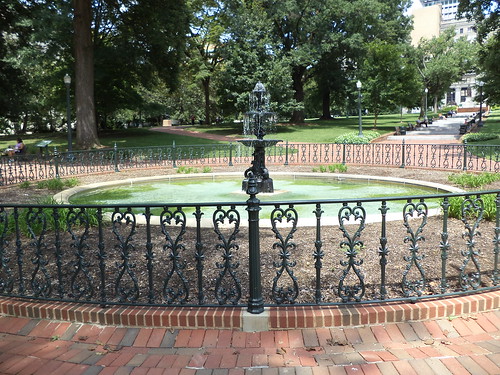
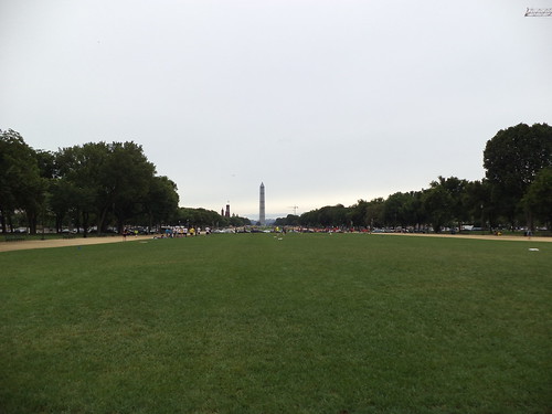
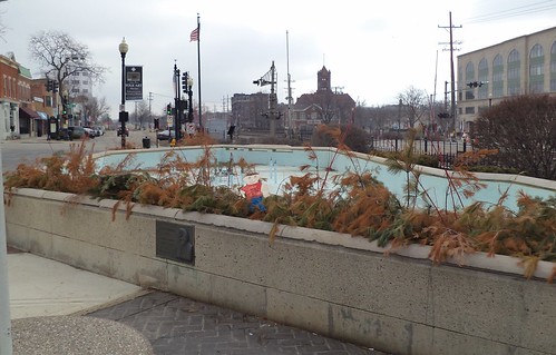
After we went to the library building, we went into Adams Park, itself. The park is built on the site of the home of one of Chicago's prominent merchants, John Quincy Adams, a 4th cousin of the 6th president. In the center of the park is a fountain. It was covered for the winter.


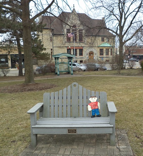
Turning to our right, we can see the DuPage Historical Museum.


This limestone structure was, originally, the Wheaton Memorial Library, and was built in honor of Adams' wife. Wheaton and Downer's Grove were the only DuPage towns to have a public library at the end of the 19th century. In 1967, the current library was built and the historical society moved in.

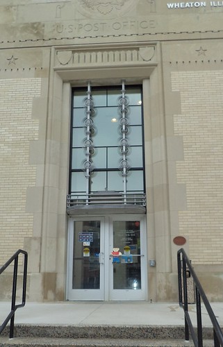
From there, we went to other important places in Wheaton. We stopped by the post office.


This building is on the National Register of Historic Places. It was build in 1933, during the Great Depression and is classified as a Works Progress building. The interior has changed quite a bit since I moved here but the exterior has been lovingly preserved.

Across the street from the post office is city hall.


One of Chicago's claims to fame was being the railroad hub of the US. If you wanted to get freight from the west to the east or the east to the west with any speed, you had to route it through Chicago. Part of that legacy goes through Wheaton. It started with the Galena and Western in the post Civil War years and continues with the Union Pacific today.

The other facet of railroad life is the need to move people. In the late 19th Century, this concept was seen with some now suburban towns being viewed as vacation destinations. Glen Ellyn, the town immediately to my east, has a lake just off their downtown. Chicagoans would take the train to Glen Ellyn to spend vacations at the large hotels that sprang up around Lake Ellyn. An electrified railroad, the Chicago, Aurora and Elgin, ran from Franklin Park to the western cities of Aurora and Elgin. This was an early commuter railroad. When it folded, the right of way from Melrose Park to Aurora and Elgin was given to a non-profit and turned into the Illinois Prairie Path.

As Chicago grew, the need to get people from the growing suburban community to their jobs in the city caused the railroads to add commuter service. Each railroad had its own service, but by the 1970's, they all wanted to abandon passenger service. It just wasn't making any money. The Illinois legislature created the Regional Transportation Authority, which became the Commuter Rail Service Board which became Metropolitan Rail or Metra, in 1987. It is said the city of Chicago's population triples during the work week as dozens of commuter trains bring people into the city for their jobs.

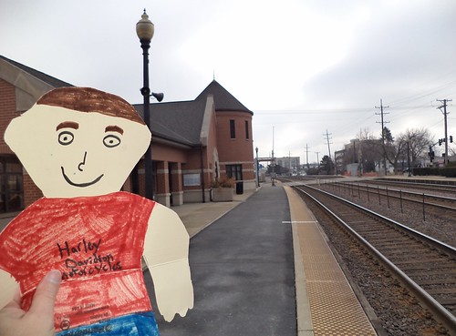
Wheaton has two stations. This is the main station, located to the west of the downtown.


The railroad really cuts the city in half. It's located right in the downtown area and 5 blocks from my house. This is not the original station that was here when I moved here. That station was twice this size but had been renovated to the end of its useful life. It was completely torn down and this station built on the same site. I live by the College Avenue Station. That place started as little more than a brick bus-type shelter but was rebuilt to a station the same size as the downtown station to reflect the quantity of people who use it.

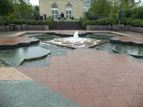
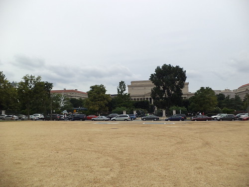
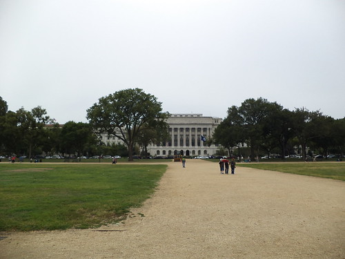
From here, we went to downtown Wheaton. The big attraction in downtown Wheaton is Martin Plaza.


Robert Martin was a well-liked mayor of Wheaton who passed away while in office. He spear-headed the drive to redo the front streets of downtown to make them more interesting and inviting to residents. When Front Street, as it's called, was redone from Hale to Main (the street immediately east of this plaza), fountains were added and this public area designed to give people a place to congregate.

In the distance, the spired building is the former DuPage County Courthouse. This building was built in the late 19th century and served as the government center of DuPage County until a new county complex was opened on the west side of Wheaton, out by the fairgrounds. It's on the National Register of Historic Places, too. It was turned into condominiums. I think that would be cool, to live in the former courthouse building. To the left, in the photo is the eastern end of downtown.

This is looking west into the heart of downtown Wheaton.


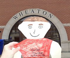
The building coming out of Stanley's head is the original Wheaton train station. As the town grew, so did the need for a bigger building. The Chicago and North Western who had absorbed the Galena and Western, built the commuter station to the west and used this building for small freight deliveries and storage. Eventually, they abandoned the building. It was purchased and restored and is in use for a hair salon and a yogurt shop.

The circular turreted building in the distance marks the intersection with Hale Street. Front Street is one-way heading towards us and Hale is one-way going right, north. Hale is the heart of downtown. When I moved here, everything I could want was in downtown, from clothing to groceries to crafts to bookstores.

Economic downturns haven't been very kind to original downtowns. Clothing stores have closed. The grocery store closed but it will be replaced by a new one a half-mile south of this area, along one of the major east west roads from Chicago. There are small businesses with niche interests and a lot of restaurants. We have a theatre company using a former bank building. We also have the Wheaton Grand Theatre, a 1920's theater that's been the subject of much discussion and debate. I remember seeing Raiders of the Lost Ark and Tron at the Wheaton Grand, when it was a movie theatre.  At the time, there were many things drawing families into downtown. Today, not so much. Yes, we have a Starbucks.

So these are the places Stanley went on our quick tour of Wheaton. It was quite a cold morning and I didn't want him to catch cold so we went home.

Beverage:  Root Beer

Deb