Showing posts with label Maryland. Show all posts

Saturday, October 26, 2013

Rollin' Home

Thursday, August 22nd, I headed home from Virginia. It had been a lovely visit. I made the decision to go a different route back because of all the construction I had encountered in Ohio.

The morning was foggy.
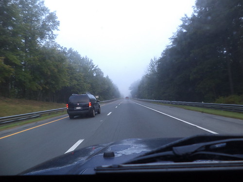

I love driving in the fog, as long as I either know the road or, in this case, it was Interstate and I could be fairly certain of the highway. The fog only lasted an hour.
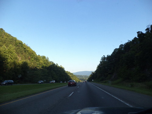

The morning was impossibly beautiful. The above photo was taken on I-64 west of Charlottesville. I hadn't seen this scenery the previous week because it was dark.

At the intersection of I-64 and I-81, I went right, north.

I drove north to almost the Pennsylvania border, meeting I-70 in Maryland, and turned left, to head west.
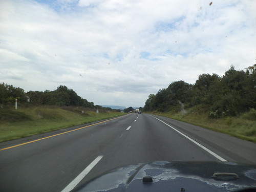

Here's where I met the mountains. I've driven this section before, back in 2011. Some of the scenery seemed familiar but it's still new. I-70 gave way to I-68 and I approached this cut through the mountains. This was familiar.

I noticed on the way out that there just weren't very many bug splats on the window. There were more on the way home, but I remember years of travel where you'd use the windshield wipers and the sprayer in an effort to get the bugs off the windows. Are there less bugs? Did I happen to travel during a time when bugs aren't plentiful? Or was my travel through a bugless area?
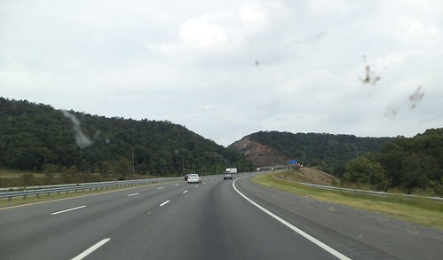

I-68 is designated the "National Freeway" and passes through some beautiful scenery in western Maryland. Notice I'm in the right lane. It was this drive where I really encountered the slowness of the Jeep. Try as I might, I couldn't build up enough steam to sustain even 60 miles per hour. My speed dropped to around 50 when I would finally clear the top of these mountains.
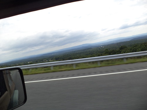

This photo is a good example of the "Blue Ridge Mountains". Notice the difference in color. The highest peak I cleared topped out at over 2800 feet. This is the time you want someone else with you so someone could take a photo of the nice sign they put up letting you know that, yes, your ears have popped because you're over 2600 feet. 

Here I am in West Virginia. 


I met up with I-79 and headed right, to the north, to Pennsylvania. 
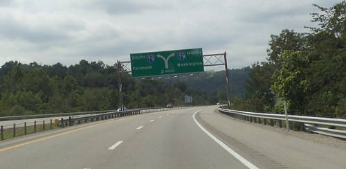

Western Pennsylvania still contains similar mountains. I knew, from checking the weather, that I could be driving into rain. Although the overcast weather in Maryland and West Virginia, kept the temperatures cool, once I got into Pennsylvania, the temperature went up, even in the mountains, by about 15 degrees. And there, like a wall, were the rain clouds. 


It turned out, however, that I drove around the rain for at least an hour. 
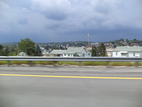

North of Pittsburgh, we met, but it wasn't much to speak of, a brief shower moving from left to right and I drove out of it as quickly as I drove into it. 
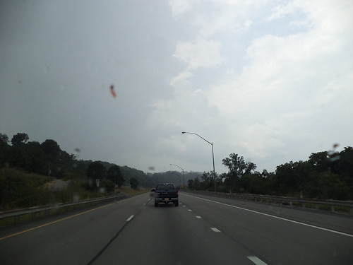

It didn't cool off the air at all. 

I picked up good old familiar Interstate 80, turned left and headed west. Oh hey! I know this intersection. 


I waved in the direction of April and Perry's. Next time, I hope my trip allows me to see all the people I know around Youngstown. 

As I headed west, I could see the rain south and west of me. It seemed like all the hype about "heavy" rain or even any kind of rain wasn't going to happen. 


But it was in western Indiana when I finally met the rain which actually cooled things off. I love driving in rain. I love the swoosh of the wipers and the rattle of the rain on the roof. In the summer, I love the change of smells from hot pavement to steamy pavement to cool, wet pavement. I love the look of the land in the rain. 


Beyond this, it grew too dark to take photos and I could feel how close home was. When I pulled in the drive, 16 hours after leaving Richmond, I was exhausted, but nothing is quite so wonderful as knowing you're home.

Would I go that route again? It's all Interstate, unlike the route out. I'm not sure. Knowing that there is major construction in Dayton and how poorly marked the intersection of the two routes was where I had to leave the Interstate and pick up the US Highway, I'm not inclined to want to go that way. But the way out was 2 hours less time and that's a strong consideration in travel. There are a number of ways to get from here to there and back again. If this becomes a yearly event, I'll have a chance to experience them all. 

Beverage:  Lady Gray Tea

Deb

Tuesday, September 3, 2013

Things I Saw - Part the Seventh

Ever think about the smells of a drive? You probably haven't because you roll up your windows, pop on your air and cruise at 75 down the Interstate. Oh the sights attract you. You probably have a CD or 2 or 3 ready for the changer or you button punch until some radio station comes into range that's playing close to things you might want to listen to for the next hour or until the signal disappears. But, I'm betting you've never thought about the smells of the open road.

I come from an era when air conditioning in a car meant opening all the windows and driving 60. Smells were everywhere. The Jeep doesn't have air conditioning. It's an "open the windows and drive 65" machine. On the way to Virginia, the wind was chilly so I spent most of the drive with the windows half open. On the way back, however, I was driving into heat, so the windows were open.

There is the smell of hot pavement. There is the smell from a semi full of cows, hogs or chickens. Chickens are the worst. Trust me on this. May you never find yourself stuck behind a truckload of chickens. The air rushing in through the windows brings the smell of haying in the fields, the smell of dirt, the smell of rain if you drive through a storm. I love the smell of freshly washed earth and the smell of driving into and out of a rain storm.

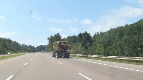
I came upon this as I was heading home on Thursday.


I had to follow him for a time because we were going uphill, into the mountains, in western Maryland, and the Jeep had slowed. At first, that natural slowing; how dare gravity tug on my vehicle; annoyed me. It was costing me valuable minutes in travel time. But then I realized that I got a better look at the scenery and had a chance to smell things I'd have passed right by.

Why is this important? This truck was hauling reasonably freshly cut pine trees. It wasn't quite like the smell of Christmas as there were diesel fumes mixed in with the pine scent, but it was close enough that I didn't mind being behind him until his speed dropped to 50 and I could easily pass.

In two months, the truckloads of Michigan fir trees will pass through the Chicagoland area on their way west for Christmas. For some reason, those don't have the smell this one load had. Made me remember that I really need to get back into crocheting scarves for presents.

Beverage:  Mixed Berry Seltzer

Deb

Thursday, June 23, 2011

This is Why I Drove

After saying, "Goodbye" to my WOW guild mates in Warrenton, mom and I headed north and then made a left to head west towards Ohio. She was the navigator. We picked up Interstate 70 and then 68 and drove through the "handle" of Maryland. As I hoped, we had wonderful views of the mountains.

We take this Interstate system for granted and we gripe when there's construction on it. I know I did. The drive from Youngstown, Ohio west across Ohio on Tuesday was filled with sections of one-lane highway. "Oh geeze. Another section where there won't be anyone working but the road is down to one lane." But, it's an engineering marvel. Here the road snakes down the mountains and through a valley, eventually going back up the mountains on the other side. In Northeast Iowa, where I grew up, there are an abundance of 2 lane roads that seem to defy gravity as they wind through the forests and along the bluffs of the Mississippi River. The shortest distance from home A to fishing point B was usually along these. No shoulder and sometimes with a drop off.

Our Interstate system allowed our economy to thrive in the 1960's. Goods could be moved extraordinarily fast. So could people. We passed over many of these 2 lane roads that snake up and around and over these mountains, true mountains, nothing like the bluffs I know. I cannot imagine how slowly goods would move without these highways.

They make driving so much easier. I put on cruise control and pretty much just steered. I remembered driving west to take Carole to Reno. Interstate 80 crosses the Great Salt Desert west of Salt Lake City, Utah. The drive is straight, the land is flat and white. You can see mountains in the distance but space is relative here. Once you enter the desert, you really don't have a concept for how big it is. You drive and drive and drive. I tried to imagine how those first settlers felt when they decided to cross this and spent days or weeks slowly working their way across it.

I'm given to understand that most roads were built along the paths of animals or the first settlers, Native Americans. There was still a great deal of hacking and slashing through underbrush but the road generally followed a trail carved out of the side of a mountain or stretched flat across a plain.

As we approached a rather impressive rock cut in western Maryland, I wondered if this area had been chosen because it was easier to blast this cut or if this had been the location of an earlier road. There is a visitor center here and a hiking trail that leads to the top of the hill for what the signs said was an "astounding view". Later research reveals this is "Sideling Hill Cut". I-68 is called the "National Freeway" because it parallels a National Road built in the 1800's. Maybe some day I'll come back and actually climb this to judge whether there really is an "astounding view".

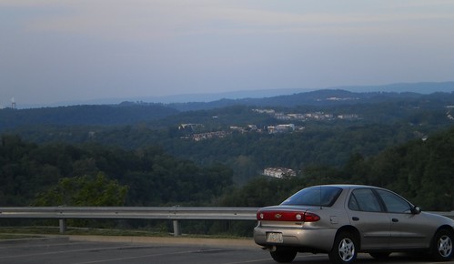
The road ended in Morgantown, West Virginia and this is where we stopped for the night. As it turned out, we were about 3 hours from April and Perry's and, had we given them some idea we were that close, might have pressed on. But we said we weren't going to be there until Monday so we stopped. There was a Cracker Barrel restaurant next to the hotel. Mom had never eaten there so that was supper. The view from the restaurant parking lot was impressive.

It's things like this that make me happy to drive places instead of fly. You can see some of the country from the air. It's a great way to see the Rockies, for instance. Looking down on them, you think how few people have been to the top of that peak or walked around the small lake you can see. But the flavor of the land, the hills, the colors, are missing when you're not down on the ground, even driving through at 70 mph.

Mom probably won't get to see these kinds of sights again so I'm glad I made the decision to change our route and drive the routes we did. She got to see and experience the Appalachian Mountains, something she'll always remember.

Beverage:  water

Deb

Saturday, May 28, 2011

Are We There Yet?

A road trip such as driving from Illinois to Virginia, gives one a good taste of the country. It may be quicker to fly, but the sights along the way and the chance for a random meander make a drive, it you can do it, the more pleasurable experience. I love to fly, and when Carole lived in Seattle, it was the only way to go see her. But I had the vacation time and the ability to drive to the wedding made the trip more enjoyable. Still, when the odometer rolls over 50, 100, 150, 250, 500 miles, you want to know that you're making some sort of progress.

We traveled a lot when I was in my teens. My dad had wanderlust, that desire to see this country, to go places which were just names on a map. Every year from about 1969 through 1975, and possibly beyond but I didn't go after graduating from high school, we packed the van with camping supplies and spent a week to two weeks on the road, seeing America. Grandpa and my uncle Leroy took care of the farm. We went to the Black Hills and Devil's Tower; northern Minnesota and the headwaters of the Mississippi; Springfield to walk in Lincoln's steps; Chicago and Cubs baseball (they lost); and a two week swing south through Tennessee, North Carolina, Alabama, Mississippi, Louisiana and back straight north along the Mississippi.

One of the things we looked for was the state signs. We would watch, when the map said we were getting close, for that elusive sign that said you had left Iowa and entered Illinois. Some of the signs were small and you'd miss them. Others were larger, particularly on interstates. That's still true today, although I think every road into a state is now marked by a large sign, lest you forget you have entered new territory. I like to document these signs. It's a visual representation of a trip, a marker of where you were.

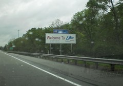
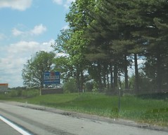
 I drove the entire trip with Mom as navigator. On Wednesday, May 18th, there were only 2 signs to see. There was Indiana as we left the Chicagoland area heading east on a drizzly, foggy, overcast morning, and Ohio, as we drove onward to April and Perry's. It was still overcast as we headed into Ohio but the clouds parted until around Cleveland. Then we hit some heavy rains. Those cleared out as we reached Youngstown.

Thursday was the day of many signs. The first was, of course, going from Ohio into Pennsylvania on the turnpike. We drove along the Pennsylvania Turnpike for awhile before the directions told us to leave it behind. The roads the directions selected; I-70, US 30, US 522, VA 37, I-81; took us quickly through Maryland and West Virginia. Before we quite knew where we were, Virginia arrived and I never got photos of any of the signs.

Coming back was a different story. I hadn't really liked the route selected by the trip finder. It was direct, no question about that, but part of it had been through small towns on two-lane roads. We hadn't really seen the things I wanted to see. Ironically, I knew some of the best views were not from the two-lane highways but from the interstate.

So, heading back to Youngstown on Sunday, May 22nd, we drove north from Warrenton and picked up I-66 heading west to I-70. A later post will have some of the views from the interstate as we headed through the Great Smokey Mountains. I bought a road atlas on Sunday. Funny how the one from 2005 really isn't what you want. Mom watched the map and alerted me to when we would reach a state line.

First up was Maryland. We drove along the pan-handle of Maryland on I-70 to I-68. It's a gorgeous trip, really. Good roads and stunning views. It's quick but there are still mountains to cross and valleys to traverse.

We had just briefly, on the two-week trip in the 1970's, been in the Great Smokey Mountains when we wandered into Pigeon Forge. I remember one look out station where we stopped, but we were not heading the right way so we turned around, found the correct road and headed back south towards Huntsville, Alabama. This highway mom and I found ourselves on was a delight for her. She got to see the mountains, something she may never do again.

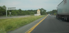
As the drive was so easy, we kept going until about 6:30. By then, we had crossed into West Virginia and had decided to stop in Morgantown. Yes, this blurry photo is the state sign for West Virginia. It was brilliantly sunny, we were going uphill and the windshield was dirty, but we'd made exceptional time and we collapsed in a hotel room for a good night's sleep.

It turned out we were about 2.5 hours from April and Perry's. Well, we weren't really expected so soon so we slept in, got breakfast and gas and took our time getting going in the morning. I missed the sign which told us of the arrival into Pennsylvania. I think there was a truck in the right lane and I was passing it. We hit rain as we approached Ohio. It rained off and on before clearing up for the afternoon. Heavy storms with tornado warnings were in the evening and north of us.

Tuesday, it was time once again, for the longest travel day of the trip, Youngstown to Wheaton. We'd made the trek out in around 8 hours. Perry said we should be back at my house about 6 p.m. his time. We fortified ourselves with a good breakfast and got on the road.

Ohio is big and long. Going out, it didn't seem quite so big. Maybe it was the anticipation and excitement of starting a journey. Coming back, gad that's a long state. I quipped to my mother that it seemed as if they had added extra miles as the Indiana state line seemed to never come. It didn't help that every 50-75 miles, there was road construction and lanes would be reduced to one, going 50 miles an hour. I don't think I've ever been more happy to see the Indiana sign.

It took a little over 2 hours to get across Indiana. I've made parts of this drive before so it felt like a dash and when I-80 meets up with I-94, I know the home stretch is approaching.

That home stretch is covered in concrete. Unlike the somewhat bucolic settings for every other state sign, the northeastern corner of Illinois is highway, highway that seems to be in a permanent state of construction. There was the sign, tacked to an overpass and I knew exactly where we were and just how long it would take us to get from this point to my driveway. We pulled in 15 minutes shy of 5 p.m., 6 p.m. Perry's time.

I look back through these photos and remember passing the signs. They document a journey, a wonderful journey, a chance to spend time with my mom and my friends and to see the landscape, places different from where I live.

Beverage:  Scottish Blend tea

Deb