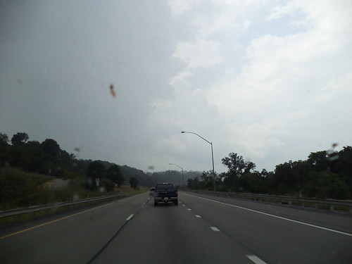
Here's a collection of photos from Thursday, November 5th. Let's start with the mountains.
This is the view from the Mickey ferris wheel. The real mountains are in the distance with the fake mountains from the Cars Land ride in the foreground. The fake mountains don't look all that out of place from the real ones due to the realism of the fake ones. I also like the clouds in the sky. Just needs a couple of vertical lines and you'd have a tic tac toe game in the sky.
How about a fountain?
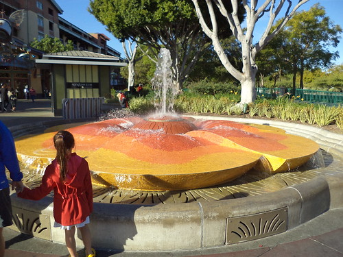
This one is in Downtown Disney. It's a stylized flower. I like the undulating shapes and the gradation of color from center outward. There aren't a lot of fountains around. It wasn't until I was looking through my photos that I realized this isn't a part of the decoration in either park. Fountains take space and they tend to break up a path. Disney is about funneling large amounts of people from one point to another. A fountain is just in the way. Oh you could tuck it off the the side. This one was alongside a thoroughfare, but that seems to defeat the purpose of a fountain as a focal point. This one is quite pretty. The color change was achieved with small tiles. Wonder how long it took people to apply the tiles?
Speaking of tiling, here is the floor in the pseudo French Quarter of Disneyland.
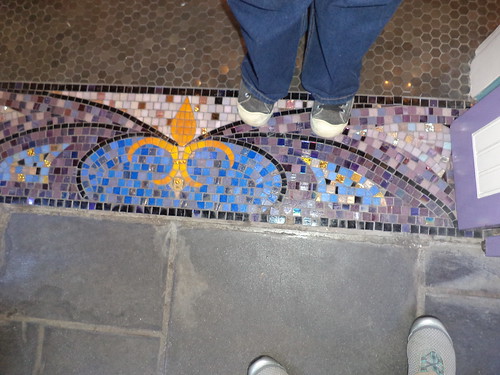
Attention to design is paramount at Disney. Liz pointed out, on many occasions, where you could find the outline of Mickey in the architecture and design of both California Adventure and Disneyland. While Mickey's not here, on the floor of the Pandora Jewelers, I like the use of tile to create a mosaic which fit with the surroundings. I see things like this and I remember working in mosaics in an art class in college. We worked with heavy paper and the section on mosaics was to help us understand color. If I wasn't so busy with other craft projects...
Color and design on the ground is not limited to mosaics. Witness what they did with colored cement.
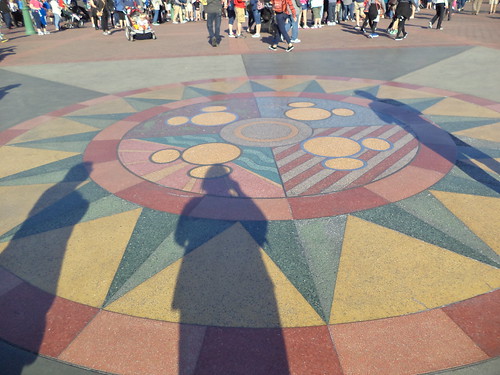
"Cement" is a bit of a misnomer for this ground covering. It's an aggregate which can be tinted in a large number of colors. I've seen this in a lot of places. One of the problems with it in cold climates is that the colors are usually separated by thin pieces of metal. The surface is sealed so you never feel the change from one piece to another. But, the ground freezes in the upper Midwest, so spring heave is a big concern. I've had to inspect designs such as these and you find all sorts of cracks at corners and uneven heave can produce a large crack in, say, the middle of one of the yellow triangles. Ground issues are probably not a problem in Southern California, so they are free to be inventive with the design and color. It was quite impressive.
I would do this in a heartbeat if I could figure out how.
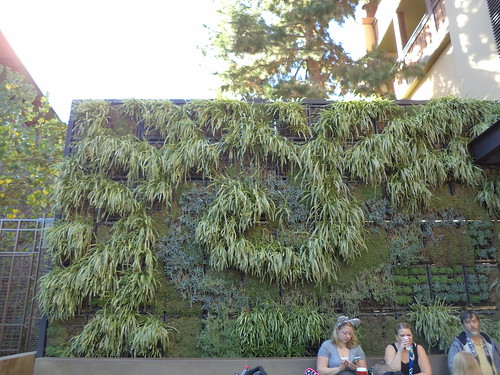
This was outside the Starbucks where we had breakfast. It's a mesh in which a variety of plants have been planted in what appeared to be a peat-like potting soil. This would be a wonderful way to shade a patio. I could see it planted with flowering plants to provide color. It appeared to have a design to the plantings but was in the midst of a change of seasons so some plants were new and not completely filled out. I also loved that, unlike Disneyland, there were birds nesting in the mesh. That, alone, appealed to me. I'm all about providing habitat for nesting birds. I'm sure, if I looked, there are plans online for something like this. You'd need it to be fairly high to block out the sun, but you could make it merely 6-7 feet tall to act as a screen.
Could it get any better than this?
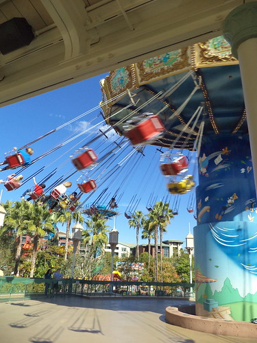
Part of the design of California Adventure is the recreation of an early American amusement park. Witness the roller coaster and the ferris wheel. LOOK! SWINGS! Liz and I walked toward the ferris wheel and she pointed out this ride. I love this ride! I am at the edge of fitting into the chairs but it was an absolute hoot. I have so many, many warm memories of county fairs with a swing ride. I wouldn't go up in a ferris wheel, but I'll let a ride fling me almost sideways with nothing but a chain to hold me to the top. You are never too old to have your feet dangling in front of you, the wind in your face, giggling for all your worth, while your 9 year-old self comes bubbling to the top for a ride. That's Disneyland, for you. It's okay to be on the backside of your middle ages yet riding swing rides.
Beverage: Raspberry Seltzer
Deb
Showing posts with label mountains. Show all posts
Wednesday, February 10, 2016
The Random View of Thursday at Disneyland
Labels:
Art,
California,
color,
Disneyland,
fountain,
garden,
memories,
mosaic,
mountains,
travel,
vacation
Tuesday, April 21, 2015
There Was a Wedding - Part 1 - Getting There
On Saturday, March 21st, Carole and Larry married. It was a glorious event. In contrast to the previous wedding Carole was a part of, this one was more relaxed, much more fun, a celebration in the truest sense of the word.
Step one of the process was actually getting to Virginia. My mother was able to come along. At first she said she couldn't, but my sister and I did an "end around", so to speak and arranged things with her husband's children to check in on him so she could come. Then, my niece was going to drive her as far as Clinton, Iowa, where I'd meet her so she wouldn't be driving the 5 hours on her own. But that plan fell through. So, mom just hopped in her car and drove herself, taking all the time she needed to make it here.
I rented a car as I have done the last few times I've gone to Carole's. It's so much nicer to rent than bounce out there in the Jeep. This time, I got a Chrysler 200. The dash board looked like the controls of an airplane.
I don't think I'd take this style of car again.
We never did figure out what all the buttons did, plus, it did not come with a CD player. You were to hook up your cell phone to the radio to play your music. As someone who does not have music on her cell phone, this is not a plus for the car. I neglected to take a full photo of the car. It was roomy and comfortable, but the lack of either satellite radio or a CD player made this a "thumb's down". There were a couple good things. The gas mileage was very good which cut the cost of the trip and it had push button start. That took a bit of getting used to but it was nice.
We headed east at 6 a.m. into a cloudy sunrise. Traffic eastbound on Interstate 80 slowed to a stop and we sat and we sat and we sat. There had been one of those rear ender accidents involving 3 cars, one of which was heavily damaged. Of course, people had to slow down to look. While this was being cleared, 5 cars tagged each other so that effectively closed the Interstate for about 20 minutes while vehicles were moved to the side and police could come and sort things out. We met all of this as it was slowly unpacking itself, but we spent a good 30 minutes going 3 miles.
Once away from the Chicagoland area and into Indiana, the sun came up and we had a nice drive.
Ohio is the worst part. Perhaps that's why they have the best restroom and eating facilities. The road is flat and there's not a lot of "scenery" until you get to the eastern quarter of the state. Pennsylvania goes by fast because it's hilly. Then, in quick succession, you go through Maryland, a bit of West Virginia and you're into Virginia. Slowly, the Blue Ridge Mountains start showing up.
We have to go over this thin line of mountains and through part of the Shenandoah Valley to get to our destination. By this time, the sun is low on the horizon.
Twelve hours after we started, we pulled into the driveway. I've done this drive 4 times now. The best thing I ever did was listen to Pam and rent a car. If I can have my tunes with me, the time goes by fairly rapidly.
So we have arrived. The next day is the rehearsal and one more thing sandwiched into a jam packed weekend.
Beverage: Water
Deb
Labels:
Blue Ridge Mountains,
Carole,
driving,
Illinois,
Indiana,
Interstate,
Larry,
mom,
mountains,
niece,
Ohio,
Pam,
rental car,
sister,
travel,
Virginia,
wedding
Saturday, October 26, 2013
Rollin' Home
Thursday, August 22nd, I headed home from Virginia. It had been a lovely visit. I made the decision to go a different route back because of all the construction I had encountered in Ohio.
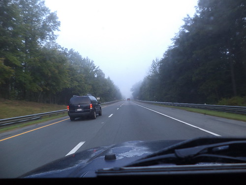
The morning was foggy.
I love driving in the fog, as long as I either know the road or, in this case, it was Interstate and I could be fairly certain of the highway. The fog only lasted an hour.
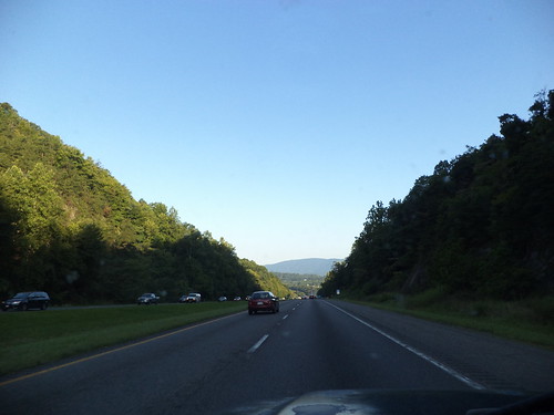
The morning was impossibly beautiful. The above photo was taken on I-64 west of Charlottesville. I hadn't seen this scenery the previous week because it was dark.
At the intersection of I-64 and I-81, I went right, north.
I drove north to almost the Pennsylvania border, meeting I-70 in Maryland, and turned left, to head west.
Here's where I met the mountains. I've driven this section before, back in 2011. Some of the scenery seemed familiar but it's still new. I-70 gave way to I-68 and I approached this cut through the mountains. This was familiar.
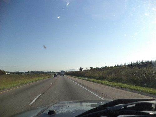
I noticed on the way out that there just weren't very many bug splats on the window. There were more on the way home, but I remember years of travel where you'd use the windshield wipers and the sprayer in an effort to get the bugs off the windows. Are there less bugs? Did I happen to travel during a time when bugs aren't plentiful? Or was my travel through a bugless area?
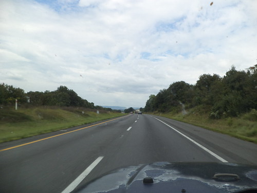
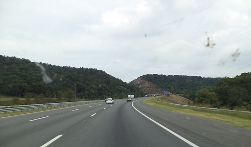
I-68 is designated the "National Freeway" and passes through some beautiful scenery in western Maryland. Notice I'm in the right lane. It was this drive where I really encountered the slowness of the Jeep. Try as I might, I couldn't build up enough steam to sustain even 60 miles per hour. My speed dropped to around 50 when I would finally clear the top of these mountains.
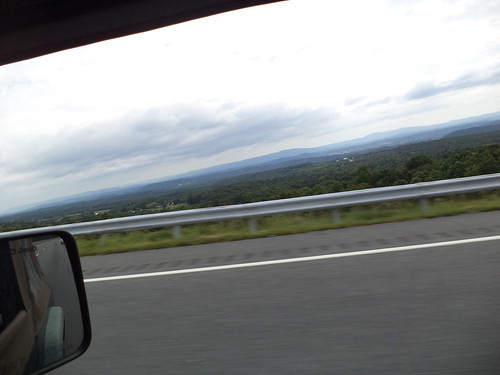
This photo is a good example of the "Blue Ridge Mountains". Notice the difference in color. The highest peak I cleared topped out at over 2800 feet. This is the time you want someone else with you so someone could take a photo of the nice sign they put up letting you know that, yes, your ears have popped because you're over 2600 feet.
Here I am in West Virginia.
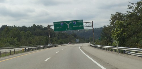
I met up with I-79 and headed right, to the north, to Pennsylvania.
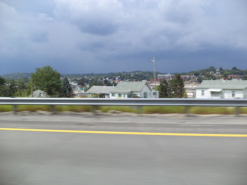
Western Pennsylvania still contains similar mountains. I knew, from checking the weather, that I could be driving into rain. Although the overcast weather in Maryland and West Virginia, kept the temperatures cool, once I got into Pennsylvania, the temperature went up, even in the mountains, by about 15 degrees. And there, like a wall, were the rain clouds.
It turned out, however, that I drove around the rain for at least an hour.
North of Pittsburgh, we met, but it wasn't much to speak of, a brief shower moving from left to right and I drove out of it as quickly as I drove into it.
It didn't cool off the air at all.
I picked up good old familiar Interstate 80, turned left and headed west. Oh hey! I know this intersection.
I waved in the direction of April and Perry's. Next time, I hope my trip allows me to see all the people I know around Youngstown.
As I headed west, I could see the rain south and west of me. It seemed like all the hype about "heavy" rain or even any kind of rain wasn't going to happen.
But it was in western Indiana when I finally met the rain which actually cooled things off. I love driving in rain. I love the swoosh of the wipers and the rattle of the rain on the roof. In the summer, I love the change of smells from hot pavement to steamy pavement to cool, wet pavement. I love the look of the land in the rain.
Beyond this, it grew too dark to take photos and I could feel how close home was. When I pulled in the drive, 16 hours after leaving Richmond, I was exhausted, but nothing is quite so wonderful as knowing you're home.
Would I go that route again? It's all Interstate, unlike the route out. I'm not sure. Knowing that there is major construction in Dayton and how poorly marked the intersection of the two routes was where I had to leave the Interstate and pick up the US Highway, I'm not inclined to want to go that way. But the way out was 2 hours less time and that's a strong consideration in travel. There are a number of ways to get from here to there and back again. If this becomes a yearly event, I'll have a chance to experience them all.
Beverage: Lady Gray Tea
Deb
Labels:
Appalachian Mountains,
April,
driving,
fog,
home,
Indiana,
Interstate,
Jeep,
Maryland,
mountains,
Ohio,
Pennsylvania,
Perry,
photography,
rain,
sunrise,
travel,
vacation,
Virginia,
West Virginia
Wednesday, September 18, 2013
The Things I Saw - Part the Fourteenth
Landscapes. Difference. Beauty.
Ohio isn't much different than Iowa.
I could be on the road to visit my mom instead of somewhere on US 35, southeast of Dayton, heading towards West Virginia. Corn. Miles and miles of corn. Blue sky. Puffy clouds.
And then I reached the Ohio River and crossed into eastern West Virginia. The photos below, of Charleston, hint at the driving to come. From there, it was up into the mountains.
We don't have mountains out here in the midwest. We have hills and valleys. Sometimes, as when you're walking the Fire Trail at Effigy Mounds National Park, those hills can seem like mountains, but they aren't really mountains.
I was directed to get off the West Virginia Turnpike and follow Interstate 64 east. These don't look that intimidating.
As I drove into and out of the shadows of the hills, the air temperature dropped noticeably. I had the driver's side window half-way open at this point, and it was interesting to go from a fully sunlit section to shade and feel the air coming in the window drop in temperature.
Our ancestors took paths of least resistance. Going through the mountains with a wagon and horses must have been arduous.
We have the technology to cut through those mountains. That lane on the right is where I discovered I would spend a great deal of time on an upward climb. The Jeep is a good traveler, but for horsepower going up, it would slow down. I think the slowest I ever climbed was at 50 mph. It does give you time to look at what's around you.
And then you cross the top of this particular mountain and it's smooth sailing down into the valley.
Setting down a road through the Appalachian Mountains is quite the feat of engineering. The past of least resistance, the trail used by our forefathers to get through this space, was followed in some locations. But getting from point A to point B sometimes meant bridging the gap between the hills. To the traveling public's ease, there are often long sections of straight road.
It hugs the right side of one hill and the left side of another with a bridge over the gap between them.
The road is separated here by a median of trees. There is a peace to travel here. Few cars, few trucks. Just me and the music, Benny Goodman at this point, and the sky and the sun and the clouds and the shade. You don't see this scenery around Wheaton, Illinois.
I came over a rise and saw the patterns on the mountains.
I wondered how they got the different colors of trees. Then it hit me. Those color changes are the shadows of the clouds.
I leave you with two more photos taken in eastern West Virginia. This area is in Great Smoky Mountains National Forest.
It's clearly evident why they are called "The Smokies".
Some day I want to go back and drive the Smoky Mountain Parkway just because it's there.
Beverage: Earl Gray tea
Deb
Labels:
Appalachian Mountains,
driving,
Interstate,
Iowa,
Jeep,
mountains,
Ohio,
photo,
photography,
scenery,
travel,
Virginia,
West Virginia,
Wheaton
Thursday, June 23, 2011
This is Why I Drove
After saying, "Goodbye" to my WOW guild mates in Warrenton, mom and I headed north and then made a left to head west towards Ohio. She was the navigator. We picked up Interstate 70 and then 68 and drove through the "handle" of Maryland. As I hoped, we had wonderful views of the mountains.
We take this Interstate system for granted and we gripe when there's construction on it. I know I did. The drive from Youngstown, Ohio west across Ohio on Tuesday was filled with sections of one-lane highway. "Oh geeze. Another section where there won't be anyone working but the road is down to one lane." But, it's an engineering marvel. Here the road snakes down the mountains and through a valley, eventually going back up the mountains on the other side. In Northeast Iowa, where I grew up, there are an abundance of 2 lane roads that seem to defy gravity as they wind through the forests and along the bluffs of the Mississippi River. The shortest distance from home A to fishing point B was usually along these. No shoulder and sometimes with a drop off.
Our Interstate system allowed our economy to thrive in the 1960's. Goods could be moved extraordinarily fast. So could people. We passed over many of these 2 lane roads that snake up and around and over these mountains, true mountains, nothing like the bluffs I know. I cannot imagine how slowly goods would move without these highways.
They make driving so much easier. I put on cruise control and pretty much just steered. I remembered driving west to take Carole to Reno. Interstate 80 crosses the Great Salt Desert west of Salt Lake City, Utah. The drive is straight, the land is flat and white. You can see mountains in the distance but space is relative here. Once you enter the desert, you really don't have a concept for how big it is. You drive and drive and drive. I tried to imagine how those first settlers felt when they decided to cross this and spent days or weeks slowly working their way across it.
I'm given to understand that most roads were built along the paths of animals or the first settlers, Native Americans. There was still a great deal of hacking and slashing through underbrush but the road generally followed a trail carved out of the side of a mountain or stretched flat across a plain.
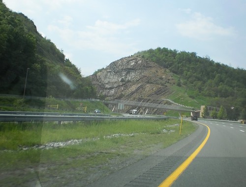
As we approached a rather impressive rock cut in western Maryland, I wondered if this area had been chosen because it was easier to blast this cut or if this had been the location of an earlier road. There is a visitor center here and a hiking trail that leads to the top of the hill for what the signs said was an "astounding view". Later research reveals this is "Sideling Hill Cut". I-68 is called the "National Freeway" because it parallels a National Road built in the 1800's. Maybe some day I'll come back and actually climb this to judge whether there really is an "astounding view".
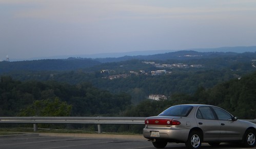
The road ended in Morgantown, West Virginia and this is where we stopped for the night. As it turned out, we were about 3 hours from April and Perry's and, had we given them some idea we were that close, might have pressed on. But we said we weren't going to be there until Monday so we stopped. There was a Cracker Barrel restaurant next to the hotel. Mom had never eaten there so that was supper. The view from the restaurant parking lot was impressive.
It's things like this that make me happy to drive places instead of fly. You can see some of the country from the air. It's a great way to see the Rockies, for instance. Looking down on them, you think how few people have been to the top of that peak or walked around the small lake you can see. But the flavor of the land, the hills, the colors, are missing when you're not down on the ground, even driving through at 70 mph.
Mom probably won't get to see these kinds of sights again so I'm glad I made the decision to change our route and drive the routes we did. She got to see and experience the Appalachian Mountains, something she'll always remember.
Beverage: water
Deb
Labels:
Carole,
driving,
Interstate,
Iowa,
Maryland,
mom,
mountains,
scenery,
travel,
Virginia,
wedding,
West Virginia
Subscribe to:
Posts (Atom)